


Rich Mountain Fire Tower
5 Miles – Moderate
This low-trafficked, 5 mile out-and-back hike on the Appalachian Trail has spectacular 360 degree views of the mountains atop a restored fire tower.
Trail Description
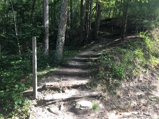
The hike begins with a moderate climb on the white-blazed Appalachian Trail. Hikers will find themselves walking through rhododendron tunnels and scenic forest slopes. The trail crosses several small streams as the path snakes up Rich Mountain.
The trail varies in steepness but allows many flat sections for hikers to recover. Roots and rocky sections are scattered throughout this section of the Appalachian Trail, please take caution when traversing this hike. Hiking sticks are recommended.
The trail slowly climbs for nearly 2.5 miles until finally reaching an intersection with a blue-blazed trail. Follow the blue-blazed trail for several hundred feet where the trail opens up and reaches the stunning Rich Mountain Firetower. At this point hikers have climbed nearly 1,430 feet!
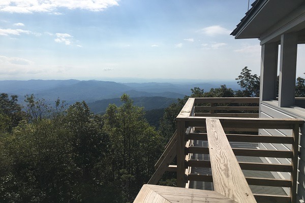
The Firetower stands 31 feet tall and is open to the public. Take caution when climbing the firetower stairs and enjoy the breath-taking views of the Appalachian Mountains from the top.
There are no waste bins or bathrooms at the firetower, please prepare accordingly and do not leave any litter at the firetower or on the trail.
The views from atop the firetower are stunning no matter what time of the year. Be sure to drink some water, have a snack and take in the views before returning on the same trail hiked in on.
PLEASE NOTE: Respecting nature is an essential responsibility we bear as inhabitants of this planet. By treating nature with reverence and care, we acknowledge its intrinsic value and the profound impact it has on our lives. It involves mindful consumption, minimizing waste, and adopting eco-friendly alternatives. Embracing nature’s beauty and power, we strive to preserve its pristine landscapes, clean air, and pure waters for future generations. Please be mindful when hiking our trails, rafting our rivers and exploring our beautiful mountains. Please leave no trace and respect the nature of Madison County, North Carolina during your visit. Click here to find out more about respecting nature in Madison County, NC.
Directions
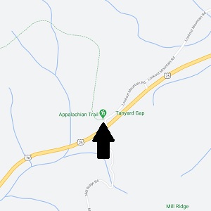
Driving from Asheville: Take I-26 W towards Weaverville for 8 miles. Take exit 19A onto US-25/US-70 towards Marshall for 23 miles. Turn right onto Lookout Mountain Road at Tanyard Gap and turn left at the intersection to reach the parking area and trailhead.
Driving from Hot Springs: Head Northeast on US-25/US-70 across Bridge Street and over the French Broad River. In approximately 3 miles turn left onto Lookout Mountain Road. At the immediate intersection turn left and follow the road approximately 0.2 miles to the trailhead and parking near the Mill Ridge Road bridge.